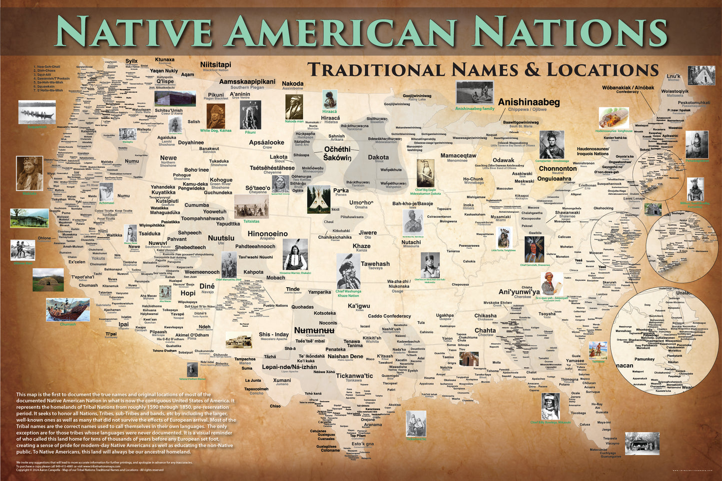

Native America Map w/ State Borders, Native & Common Names — 24"x36" Poster
Native America Map w/ State Borders, Native & Common Names — 24"x36" Poster
Couldn't load pickup availability
Beautiful, comprehensive map showing over 1,100 historic Tribal locations on their homelands prior to removal to reservations.
Native America Map w/ State Borders, Native & Common Names — This map comes with the modern-day state borders, traditional Tribal names (autonyms) and the commonly-known Tribal names.
- Orders are fulfilled by Tribal Nations Maps.
- $59.00 + $15 shipping fee covers any damage, or replacements due to damage.
- 24"x36" high-quality poster
Tribal Nations Maps is a Native-owned business on the Muscogee-Creek Nation in Oklahoma. Each map is informed by pouring thousands of hours into books, investigating in library archive buildings, making phone calls and traveling to remote reservations in the spirit of creating the most thorough map of Native America in existence!
Maps are a valuable educational tool that preserves the presence of Native American tribes. Read on at www.tribalnationsmaps.com.
Share